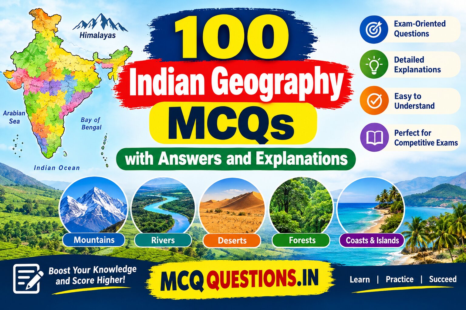
100 Indian Geography MCQs with Answers and Explanations
100 Indian Geography MCQs with Answers and Explanations
These 100 Indian Geography multiple-choice questions are designed for UPSC, SSC, Railway, Banking, State PSC, competitive examinations, school examinations, and general knowledge practice. Each question includes four options, the correct answer, and an analytical explanation to help students understand the concept.
Topics covered: India’s physical features, mountains, rivers, climate, soils, agriculture, minerals, industries, states, lakes, islands, and population geography.
Table of Contents
Section 1: Location and Physical Features of India
1. What is the total geographical area of India?
A. 2.28 million square kilometres B. 3.28 million square kilometres C. 4.28 million square kilometres D. 5.28 million square kilometres
Correct Answer: B. 3.28 million square kilometres
Explanation: India covers approximately 3.287 million square kilometres, making it the seventh-largest country in the world by geographical area.
2. Which is the southernmost point of mainland India?
A. Indira Point B. Kanyakumari C. Rameswaram D. Kochi
Correct Answer: B. Kanyakumari
Explanation: Kanyakumari, in Tamil Nadu, is the southernmost point of mainland India. Indira Point, located in the Great Nicobar Island, is the southernmost point of Indian territory.
3. Which mountain range forms India’s northern natural boundary?
A. Aravalli Range B. Vindhya Range C. Himalayas D. Satpura Range
Correct Answer: C. Himalayas
Explanation: The Himalayas form a major mountain barrier along India’s northern and northeastern region. They influence climate, river systems, and the distribution of rainfall.
4. Which is the oldest mountain range in India?
A. Himalayas B. Aravalli Range C. Western Ghats D. Purvanchal Range
Correct Answer: B. Aravalli Range
Explanation: The Aravalli Range is one of the oldest fold mountain systems in the world. It extends mainly across Rajasthan and continues toward Haryana and Delhi.
5. Which is the highest mountain peak located entirely within India?
A. Nanda Devi B. Kanchenjunga C. Anamudi D. Kamet
Correct Answer: A. Nanda Devi
Explanation: Nanda Devi, at approximately 7,816 metres, is the highest peak located entirely within India. Kanchenjunga is higher, at about 8,586 metres, but lies on the India–Nepal border.
6. Which is the highest peak in the Western Ghats?
A. Doddabetta B. Anamudi C. Mahendragiri D. Guru Shikhar
Correct Answer: B. Anamudi
Explanation: Anamudi, approximately 2,695 metres high, is situated in Kerala. It is the highest peak in both the Western Ghats and peninsular India.
7. Which plateau occupies a large part of southern India?
A. Malwa Plateau B. Chota Nagpur Plateau C. Deccan Plateau D. Meghalaya Plateau
Correct Answer: C. Deccan Plateau
Explanation: The Deccan Plateau covers a large part of peninsular India. It is an elevated region bounded broadly by the Western Ghats, Eastern Ghats, and other surrounding uplands.
8. Which Indian state contains the Thar Desert’s largest area?
A. Gujarat B. Haryana C. Rajasthan D. Punjab
Correct Answer: C. Rajasthan
Explanation: The Thar Desert, also known as the Great Indian Desert, lies mainly in western Rajasthan and extends into parts of Gujarat, Punjab, and Haryana, as well as Pakistan.
9. Which coastal plain lies along the Arabian Sea?
A. Eastern Coastal Plain B. Western Coastal Plain C. Northern Plain D. Coromandel Plain
Correct Answer: B. Western Coastal Plain
Explanation: The Western Coastal Plain extends along the Arabian Sea, between the Western Ghats and the coast. It includes coastal stretches of Gujarat, Maharashtra, Goa, Karnataka, and Kerala.
10. Which physical division of India was formed largely by river deposits?
A. Himalayan Mountains B. Northern Plains C. Deccan Plateau D. Western Ghats
Correct Answer: B. Northern Plains
Explanation: The Northern Plains were formed mainly by alluvial deposits brought by the Indus, Ganga, Brahmaputra, and their tributaries. These fertile plains support intensive agriculture.
Section 2: Indian Mountains, Hills and Passes
11. Which Himalayan range is also known as the Himadri?
A. Shiwalik B. Himachal C. Greater Himalayas D. Purvanchal
Correct Answer: C. Greater Himalayas
Explanation: The Himadri is the northernmost and highest continuous range of the Himalayas. It contains many of the world’s highest mountain peaks and extensive glaciers.
12. Which is the outermost range of the Himalayas?
A. Himadri B. Himachal C. Shiwalik D. Karakoram
Correct Answer: C. Shiwalik
Explanation: The Shiwalik Range forms the southernmost and outermost Himalayan belt. Its foothills contain longitudinal valleys known as duns, such as Dehradun.
13. Which mountain pass connects Srinagar with Leh along the traditional road route?
A. Nathu La B. Zoji La C. Shipki La D. Bomdi La
Correct Answer: B. Zoji La
Explanation: Zoji La is an important high mountain pass connecting the Kashmir Valley with the Ladakh region. It is strategically significant for road transport.
14. Nathu La Pass is located in which state?
A. Arunachal Pradesh B. Sikkim C. Himachal Pradesh D. Uttarakhand
Correct Answer: B. Sikkim
Explanation: Nathu La lies in the eastern Himalayas of Sikkim, near the India–China border. It is an important historic trade route.
15. The Palghat Gap separates which two mountain ranges?
A. Aravalli and Vindhya B. Nilgiri and Anaimalai C. Satpura and Vindhya D. Pir Panjal and Zanskar
Correct Answer: B. Nilgiri and Anaimalai
Explanation: The Palghat Gap is a major break in the Western Ghats between the Nilgiri Hills and Anaimalai Hills. It facilitates transport between Kerala and Tamil Nadu.
16. Which hills are located in northeastern India?
A. Garo, Khasi and Jaintia Hills B. Aravalli Hills C. Ajanta Hills D. Cardamom Hills
Correct Answer: A. Garo, Khasi and Jaintia Hills
Explanation: These hills are located in Meghalaya. The region receives heavy monsoon rainfall, particularly around the Khasi Hills.
17. Guru Shikhar is the highest peak of which range?
A. Western Ghats B. Aravalli Range C. Satpura Range D. Eastern Ghats
Correct Answer: B. Aravalli Range
Explanation: Guru Shikhar, approximately 1,722 metres high, is located near Mount Abu in Rajasthan and is the highest point of the Aravalli Range.
18. Which hills are located mainly in Odisha and Andhra Pradesh along the Eastern Ghats?
A. Nilgiri Hills B. Mahendragiri Hills C. Pir Panjal Hills D. Zanskar Hills
Correct Answer: B. Mahendragiri Hills
Explanation: Mahendragiri is an important peak in Odisha’s Gajapati district, within the Eastern Ghats. The Eastern Ghats are discontinuous and are intersected by several rivers.
19. Which mountain range separates the Narmada Valley from the Deccan Plateau to the south?
A. Vindhya Range B. Satpura Range C. Aravalli Range D. Shiwalik Range
Correct Answer: B. Satpura Range
Explanation: The Satpura Range lies south of the Narmada Valley and north of the Tapti Valley in parts of central India. It forms an important upland system.
20. Which pass is an important route between India and Tibet through Himachal Pradesh?
A. Shipki La B. Bhor Ghat C. Thal Ghat D. Palghat Gap
Correct Answer: A. Shipki La
Explanation: Shipki La is a high mountain pass in Himachal Pradesh near the India–China border. It lies in the Sutlej River region.
Section 3: Indian Rivers and River Systems
21. Which is the longest river that flows entirely within India?
A. Ganga B. Godavari C. Krishna D. Narmada
Correct Answer: B. Godavari
Explanation: The Godavari is approximately 1,465 kilometres long and is the longest river whose entire course lies within India. It is often called the Dakshin Ganga, or Ganga of the South.
22. Which river is traditionally regarded as the holiest river in India?
A. Yamuna B. Godavari C. Ganga D. Kaveri
Correct Answer: C. Ganga
Explanation: The Ganga has immense religious, cultural, and economic importance. Its basin supports a large population and extensive agricultural activity.
23. The Bhagirathi River originates from which glacier?
A. Siachen Glacier B. Gangotri Glacier C. Zemu Glacier D. Pindari Glacier
Correct Answer: B. Gangotri Glacier
Explanation: The Bhagirathi originates near Gaumukh at the Gangotri Glacier in Uttarakhand. It joins the Alaknanda at Devprayag, after which the combined river is called the Ganga.
24. Which river is known as the Tsangpo in Tibet?
A. Indus B. Ganga C. Brahmaputra D. Teesta
Correct Answer: C. Brahmaputra
Explanation: The Brahmaputra is known as the Yarlung Tsangpo in Tibet. It enters India through Arunachal Pradesh, flows through Assam, and continues into Bangladesh.
25. Which river flows through a rift valley between the Vindhya and Satpura ranges?
A. Ganga B. Narmada C. Mahanadi D. Godavari
Correct Answer: B. Narmada
Explanation: The Narmada flows westward through a rift valley between the Vindhya and Satpura ranges before entering the Arabian Sea through the Gulf of Khambhat.
26. Which river is known as the Dakshin Ganga?
A. Krishna B. Kaveri C. Godavari D. Mahanadi
Correct Answer: C. Godavari
Explanation: The Godavari is called the Dakshin Ganga because of its length, extensive basin, and importance to peninsular India.
27. Which river forms the famous Jog Falls?
A. Sharavathi B. Krishna C. Kaveri D. Periyar
Correct Answer: A. Sharavathi
Explanation: Jog Falls is formed by the Sharavathi River in Karnataka. The river descends dramatically over a rocky escarpment in the Western Ghats region.
28. Which river is associated with the Hirakud Dam?
A. Godavari B. Mahanadi C. Krishna D. Subarnarekha
Correct Answer: B. Mahanadi
Explanation: Hirakud Dam is built across the Mahanadi River near Sambalpur in Odisha. It supports irrigation, flood management, and hydroelectric power generation.
29. Which of the following rivers flows into the Arabian Sea?
A. Mahanadi B. Krishna C. Narmada D. Godavari
Correct Answer: C. Narmada
Explanation: The Narmada flows westward and empties into the Arabian Sea. The Mahanadi, Krishna, and Godavari flow eastward into the Bay of Bengal.
30. Which river forms a large delta with the Ganga in Bangladesh?
A. Tapi B. Brahmaputra C. Sabarmati D. Luni
Correct Answer: B. Brahmaputra
Explanation: The Ganga–Brahmaputra river system forms the world’s largest delta, commonly called the Ganges–Brahmaputra or Bengal Delta. Much of it lies in Bangladesh, with a portion in India.
31. Which river originates near Mahabaleshwar in Maharashtra?
A. Krishna B. Yamuna C. Brahmaputra D. Sutlej
Correct Answer: A. Krishna
Explanation: The Krishna originates in the Western Ghats near Mahabaleshwar and flows through Maharashtra, Karnataka, Telangana and Andhra Pradesh before reaching the Bay of Bengal.
32. Which river is an important tributary of the Ganga and originates at Yamunotri?
A. Son B. Gomti C. Yamuna D. Gandak
Correct Answer: C. Yamuna
Explanation: The Yamuna originates near the Yamunotri Glacier in Uttarakhand and joins the Ganga at Prayagraj, Uttar Pradesh.
33. The Luni River drains into which region?
A. Bay of Bengal B. Arabian Sea directly C. Rann of Kutch D. Chilika Lake
Correct Answer: C. Rann of Kutch
Explanation: The Luni flows through Rajasthan and toward the Rann of Kutch. Its lower course is associated with an arid region, and its waters do not form a major perennial river outlet into the open sea.
34. Which river is associated with the Sardar Sarovar Dam?
A. Narmada B. Tapi C. Mahi D. Sabarmati
Correct Answer: A. Narmada
Explanation: The Sardar Sarovar Dam is constructed on the Narmada River in Gujarat. It is a major multipurpose project serving irrigation, drinking-water supply, and power generation.
35. Which of the following rivers is a tributary of the Brahmaputra?
A. Teesta B. Chambal C. Betwa D. Pennar
Correct Answer: A. Teesta
Explanation: The Teesta originates in the eastern Himalayas, flows through Sikkim and West Bengal, and joins the Brahmaputra system in Bangladesh.
Section 4: Indian Climate and Monsoon
36. Which type of climate dominates most of India?
A. Mediterranean B. Tropical monsoon C. Tundra D. Equatorial rainforest throughout the country
Correct Answer: B. Tropical monsoon
Explanation: India’s climate is strongly influenced by seasonal monsoon winds. However, the country also includes arid, alpine, humid subtropical, and other climatic zones.
37. Which winds bring most of India’s annual rainfall?
A. Northeast trade winds B. Southwest monsoon winds C. Polar easterlies D. Westerlies throughout the year
Correct Answer: B. Southwest monsoon winds
Explanation: The southwest monsoon generally brings most of India’s annual rainfall between June and September. Its two main branches are the Arabian Sea branch and the Bay of Bengal branch.
38. Which state generally receives the earliest onset of the southwest monsoon over mainland India?
A. Punjab B. Kerala C. Rajasthan D. Haryana
Correct Answer: B. Kerala
Explanation: The southwest monsoon typically reaches Kerala in early June, although the exact onset date varies from year to year.
39. Which place is famous for exceptionally heavy orographic rainfall?
A. Jaisalmer B. Mawsynram C. Leh D. Bikaner
Correct Answer: B. Mawsynram
Explanation: Mawsynram in Meghalaya is renowned for extremely high average annual rainfall. Moist monsoon air is forced upward by the surrounding hills, producing heavy orographic precipitation.
40. Why does Rajasthan receive relatively low rainfall?
A. It is surrounded by oceans B. The Aravalli Range runs largely parallel to the Arabian Sea branch of the monsoon C. It receives no monsoon winds D. It lies entirely above the snowline
Correct Answer: B. The Aravalli Range runs largely parallel to the Arabian Sea branch of the monsoon
Explanation: The alignment of the Aravalli Range provides limited obstruction to the Arabian Sea branch of the monsoon. Distance from major moisture sources and other regional conditions also contribute to aridity.
41. Which season is commonly associated with retreating monsoon conditions in India?
A. January–February B. March–May C. October–November D. June–July
Correct Answer: C. October–November
Explanation: During October and November, the southwest monsoon withdraws from much of India. The retreating monsoon brings significant rainfall to parts of the southeastern coast.
42. Which state receives substantial rainfall from the northeast monsoon?
A. Tamil Nadu B. Rajasthan C. Punjab D. Himachal Pradesh
Correct Answer: A. Tamil Nadu
Explanation: Tamil Nadu receives a substantial share of its annual rainfall during the northeast or retreating monsoon, particularly from October to December.
43. What is the primary cause of the summer monsoon in India?
A. Uniform heating of land and ocean B. Differential heating of land and sea, along with large-scale atmospheric circulation C. Earth’s rotation alone D. Ocean tides
Correct Answer: B. Differential heating of land and sea, along with large-scale atmospheric circulation
Explanation: Seasonal differences in heating create pressure contrasts between the Asian landmass and surrounding oceans. The monsoon is also shaped by the migration of the Intertropical Convergence Zone, upper-air circulation, and other atmospheric processes.
44. Which region of India experiences a cold desert climate?
A. Konkan Coast B. Ladakh C. Sundarbans D. Malabar Coast
Correct Answer: B. Ladakh
Explanation: Ladakh lies in the rain shadow of the Himalayas and receives little precipitation. Its high altitude causes cold winters and large temperature variations.
45. What are mango showers?
A. Winter snowfall in Kashmir B. Pre-monsoon showers in parts of southern India C. Floods caused by Himalayan glaciers D. Cyclones in the Arabian Sea
Correct Answer: B. Pre-monsoon showers in parts of southern India
Explanation: Mango showers are pre-monsoon rains in parts of southern India, particularly Kerala and Karnataka. They can help mangoes mature and are also associated with the flowering of some plantation crops.
Section 5: Indian Soils and Natural Vegetation
46. Which soil is most suitable for cotton cultivation in many parts of the Deccan region?
A. Laterite soil B. Black soil C. Mountain soil D. Desert soil
Correct Answer: B. Black soil
Explanation: Black soil, often called regur, retains moisture well and is rich in clay. It is particularly suitable for cotton, although irrigation, drainage, and local conditions influence yields.
47. Which soil is widespread in the Northern Plains of India?
A. Alluvial soil B. Black soil C. Laterite soil D. Peaty soil only
Correct Answer: A. Alluvial soil
Explanation: Alluvial soil is deposited by rivers and is widespread in the Ganga, Indus, and Brahmaputra plains. It supports rice, wheat, sugarcane, and many other crops.
48. Laterite soils develop mainly under which conditions?
A. Very low temperatures and permanent snow B. High temperature and heavy rainfall with intense leaching C. Extremely dry conditions without weathering D. Permanent flooding by seawater
Correct Answer: B. High temperature and heavy rainfall with intense leaching
Explanation: Laterite soils form in warm, humid environments where heavy rainfall leaches soluble materials from the soil. They occur in parts of the Western Ghats, eastern India, and other tropical regions.
49. Which soil type is generally associated with arid regions of western Rajasthan?
A. Desert soil B. Peaty soil C. Tundra soil D. Deep alluvial soil exclusively
Correct Answer: A. Desert soil
Explanation: Desert soils commonly have low organic matter and limited moisture. Some areas also contain substantial soluble salts, and irrigation can improve agricultural productivity where water is available.
50. Which natural vegetation type is commonly found in areas receiving very heavy rainfall?
A. Tropical evergreen forest B. Thorn forest C. Alpine meadow only D. Temperate grassland only
Correct Answer: A. Tropical evergreen forest
Explanation: Tropical evergreen forests occur in humid areas with high rainfall and little pronounced dry season, including parts of the Western Ghats and northeastern India.
51. Which tree is commonly associated with tropical thorn forests?
A. Teak B. Babool C. Deodar D. Spruce
Correct Answer: B. Babool
Explanation: Babool, or Vachellia nilotica, is adapted to relatively dry conditions. Thorn forests also contain species such as khejri and other drought-resistant shrubs.
52. Which forest type is associated with tidal coastal environments?
A. Mangrove forest B. Alpine forest C. Tropical thorn forest D. Coniferous mountain forest
Correct Answer: A. Mangrove forest
Explanation: Mangroves grow in saline, tidal coastal environments. India’s Sundarbans are a major mangrove ecosystem, and mangroves also occur in several other coastal and deltaic regions.
53. Which of the following is a coniferous tree found in Himalayan forests?
A. Coconut B. Deodar C. Mangrove D. Babool
Correct Answer: B. Deodar
Explanation: Deodar is a Himalayan conifer that grows in suitable temperate mountain environments. Other Himalayan conifers include pine, fir, and spruce.
54. Which soil is often rich in iron and aluminium oxides?
A. Laterite soil B. Peaty soil C. New alluvial soil D. Desert sand exclusively
Correct Answer: A. Laterite soil
Explanation: Lateritic soils develop through intense chemical weathering and leaching. Their fertility varies, and many require suitable management and fertilisation for productive cultivation.
55. Which Indian region is well known for mangrove forests and the Royal Bengal Tiger?
A. Sundarbans B. Thar Desert C. Deccan Plateau D. Ladakh
Correct Answer: A. Sundarbans
Explanation: The Sundarbans is a vast mangrove landscape in the Ganga–Brahmaputra delta. It provides habitat for the Royal Bengal Tiger and numerous aquatic and terrestrial species.
Section 6: Indian Agriculture and Cropping Patterns
56. Which crop is commonly known as a kharif crop?
A. Wheat B. Mustard C. Rice D. Gram
Correct Answer: C. Rice
Explanation: Rice is commonly grown as a kharif crop and is generally sown with the onset of the monsoon. However, it is also cultivated in other seasons in regions with suitable irrigation and climate.
57. Which crop is primarily associated with the rabi season?
A. Wheat B. Jute C. Cotton D. Kharif rice
Correct Answer: A. Wheat
Explanation: Wheat is a major rabi crop, generally sown in winter and harvested in spring. Punjab, Haryana, Uttar Pradesh, and Madhya Pradesh are important wheat-producing states.
58. Which Indian state is particularly famous for tea production in the Brahmaputra Valley?
A. Assam B. Rajasthan C. Haryana D. Goa
Correct Answer: A. Assam
Explanation: Assam is one of India’s leading tea-producing states. Its warm, humid climate, abundant rainfall, and suitable soils support extensive tea plantations.
59. Which state is strongly associated with coffee cultivation in India?
A. Karnataka B. Bihar C. Punjab D. Uttar Pradesh
Correct Answer: A. Karnataka
Explanation: Karnataka is India’s leading coffee-producing state. Coffee plantations are concentrated in hilly districts such as Chikkamagaluru, Kodagu, and Hassan.
60. Which crop is the main raw material for the jute industry?
A. Cotton B. Jute C. Sugarcane D. Tobacco
Correct Answer: B. Jute
Explanation: Jute fibres are used to make sacks, ropes, mats, and other products. West Bengal is a major jute-producing state, especially in the Ganga delta region.
61. Which crop requires a relatively warm climate and a long frost-free growing period?
A. Sugarcane B. Apple C. Barley in high mountains D. Temperate pea exclusively
Correct Answer: A. Sugarcane
Explanation: Sugarcane is a tropical and subtropical crop that needs warmth and a relatively long growing season. Uttar Pradesh, Maharashtra, and Karnataka are important producers.
62. Which state is widely known for extensive rice cultivation in the Mahanadi delta region?
A. Odisha B. Rajasthan C. Himachal Pradesh D. Haryana only
Correct Answer: A. Odisha
Explanation: Rice is a major crop in Odisha, including the Mahanadi delta and other lowland regions. The state’s monsoon rainfall and irrigated areas support paddy cultivation.
63. Which crop is known as a major fibre crop of India?
A. Cotton B. Gram C. Lentil D. Barley
Correct Answer: A. Cotton
Explanation: Cotton is an important natural fibre crop used by India’s textile industry. It grows in several states, including Gujarat, Maharashtra, Telangana, and Rajasthan.
64. Which state is famous for apple cultivation in the Himalayan region?
A. Himachal Pradesh B. Kerala C. Tamil Nadu’s coastal plains D. Odisha’s coastal belt
Correct Answer: A. Himachal Pradesh
Explanation: Himachal Pradesh is an important apple-producing state. Its cooler mountain climate and suitable elevations support commercial apple orchards.
65. Which agricultural practice involves growing two or more crops simultaneously on the same field in a planned arrangement?
A. Monoculture B. Intercropping C. Shifting cultivation only D. Fallowing
Correct Answer: B. Intercropping
Explanation: Intercropping involves growing two or more crops together in a planned pattern. It can improve resource use and diversify production, depending on the crops and management practices.
Section 7: Minerals, Energy and Industries
66. Which state is a major producer of iron ore in India?
A. Odisha B. Punjab C. Haryana D. Delhi
Correct Answer: A. Odisha
Explanation: Odisha has extensive iron ore deposits, particularly in districts such as Keonjhar and Sundargarh. Iron ore is a key raw material for the steel industry.
67. Which region is historically important for India’s coal production?
A. Jharia B. Thar Desert C. Malabar Coast D. Lakshadweep
Correct Answer: A. Jharia
Explanation: Jharia in Jharkhand is a major coalfield, particularly known for coking coal. Coalfields in eastern and central India have long supported India’s power and industrial sectors.
68. Which state is especially known for the petroleum-producing region of Digboi?
A. Assam B. Gujarat C. Rajasthan D. Tamil Nadu
Correct Answer: A. Assam
Explanation: Digboi, in Assam, is one of India’s historic oil-producing centres. Assam remains an important region in India’s petroleum history.
69. Which mineral is the principal raw material for aluminium production?
A. Bauxite B. Mica C. Limestone D. Gypsum
Correct Answer: A. Bauxite
Explanation: Bauxite is the principal ore used to produce alumina, which is then processed into aluminium. Odisha has substantial bauxite deposits.
70. Which state has major deposits of mica?
A. Jharkhand B. Punjab C. Goa only D. Haryana only
Correct Answer: A. Jharkhand
Explanation: Jharkhand has historically been an important mica-producing region, particularly around the Koderma–Giridih belt. Mica is used in electrical and industrial applications.
71. Which mineral is essential for manufacturing cement?
A. Limestone B. Gold C. Mica D. Diamond
Correct Answer: A. Limestone
Explanation: Limestone supplies calcium carbonate, a key ingredient in cement production. Cement factories are often located near limestone deposits to reduce transportation costs.
72. Which state is a major producer of lignite at Neyveli?
A. Tamil Nadu B. Punjab C. Assam D. Sikkim
Correct Answer: A. Tamil Nadu
Explanation: Neyveli in Tamil Nadu is famous for its lignite deposits. Lignite has been used for electricity generation and industrial purposes.
73. Which of the following is a renewable source of energy?
A. Coal B. Petroleum C. Solar energy D. Natural gas
Correct Answer: C. Solar energy
Explanation: Solar energy comes from sunlight and is renewable on human timescales. Coal, petroleum, and natural gas are fossil fuels formed over geological periods.
74. Which state is strongly associated with the Kudankulam Nuclear Power Plant?
A. Tamil Nadu B. Rajasthan C. Bihar D. Odisha
Correct Answer: A. Tamil Nadu
Explanation: Kudankulam Nuclear Power Plant is located in Tirunelveli district of Tamil Nadu. It is an important nuclear electricity-generating facility in India.
75. Which city is widely known as the Steel City of India because of its major integrated steel plant?
A. Jamshedpur B. Jaipur C. Kochi D. Panaji
Correct Answer: A. Jamshedpur
Explanation: Jamshedpur in Jharkhand is a major industrial city associated with Tata Steel. Its development was closely linked to India’s modern iron and steel industry.
Section 8: Indian States, Coasts and Islands
76. Which is the largest Indian state by area?
A. Madhya Pradesh B. Maharashtra C. Rajasthan D. Uttar Pradesh
Correct Answer: C. Rajasthan
Explanation: Rajasthan is India’s largest state by geographical area. It occupies much of northwestern India and includes a large part of the Thar Desert.
77. Which is the smallest Indian state by area?
A. Goa B. Sikkim C. Tripura D. Manipur
Correct Answer: A. Goa
Explanation: Goa is the smallest Indian state by area. It lies on the western coast along the Arabian Sea.
78. Which Indian state has the longest coastline among the states?
A. Tamil Nadu B. Gujarat C. Kerala D. Odisha
Correct Answer: B. Gujarat
Explanation: Gujarat has the longest coastline among India’s states, extending along the Arabian Sea and the Gulfs of Kutch and Khambhat.
79. Which Union Territory is an archipelago in the Arabian Sea?
A. Puducherry B. Lakshadweep C. Chandigarh D. Delhi
Correct Answer: B. Lakshadweep
Explanation: Lakshadweep consists of islands in the Arabian Sea, west of India’s mainland. Many of its islands are coral islands or atolls.
80. The Andaman and Nicobar Islands are located in which body of water?
A. Arabian Sea B. Bay of Bengal and adjoining eastern Indian Ocean C. Gulf of Kutch D. Gulf of Khambhat
Correct Answer: B. Bay of Bengal and adjoining eastern Indian Ocean
Explanation: The Andaman and Nicobar Islands form an island chain east of mainland India. They are strategically located near major Indian Ocean shipping routes.
81. Which Indian state shares an international border with Bangladesh, Myanmar, China, and Bhutan?
A. Arunachal Pradesh B. Assam C. Nagaland D. Tripura
Correct Answer: B. Assam
Explanation: Assam shares an international border with Bangladesh and Bhutan, but not with Myanmar or China. None of the options correctly meets all four conditions. The question is therefore invalid as written.
82. Which state is known as the Land of Five Rivers?
A. Punjab B. Gujarat C. Odisha D. Kerala
Correct Answer: A. Punjab
Explanation: Punjab’s name means “land of five rivers,” referring historically to the Sutlej, Beas, Ravi, Chenab, and Jhelum. Following the partition of 1947, the Indian state of Punjab retained only parts of this historic river region.
83. Which Indian state has Chennai as its capital?
A. Kerala B. Tamil Nadu C. Karnataka D. Andhra Pradesh
Correct Answer: B. Tamil Nadu
Explanation: Chennai, located on the Coromandel Coast along the Bay of Bengal, is the capital of Tamil Nadu and a major industrial, educational, and port city.
84. Which state has the longest international land border with Bangladesh among Indian states?
A. West Bengal B. Meghalaya C. Tripura D. Assam
Correct Answer: A. West Bengal
Explanation: West Bengal shares the longest section of India’s border with Bangladesh among the Indian states. Other neighbouring states include Assam, Meghalaya, Tripura, and Mizoram.
85. Which state is associated with the famous Chilika Lake?
A. Odisha B. Gujarat C. Karnataka D. Maharashtra
Correct Answer: A. Odisha
Explanation: Chilika is a large brackish-water lagoon on the coast of Odisha. It is known for migratory birds, fisheries, and its ecological importance.
Section 9: Lakes, Dams and Water Resources
86. Which is India’s largest brackish-water lagoon?
A. Wular Lake B. Chilika Lake C. Dal Lake D. Loktak Lake
Correct Answer: B. Chilika Lake
Explanation: Chilika Lake in Odisha is India’s largest brackish-water lagoon. Its salinity changes with the seasons and the exchange of water with the Bay of Bengal.
87. Which is one of the largest freshwater lakes in India, located in Jammu and Kashmir?
A. Sambhar Lake B. Wular Lake C. Chilika Lake D. Pulicat Lake
Correct Answer: B. Wular Lake
Explanation: Wular Lake lies in Jammu and Kashmir and is an important freshwater ecosystem. Its water levels and area fluctuate with seasonal conditions.
88. Which lake is famous for its floating islands, locally known as phumdis?
A. Loktak Lake B. Dal Lake C. Sambhar Lake D. Vembanad Lake
Correct Answer: A. Loktak Lake
Explanation: Loktak Lake in Manipur is famous for floating masses of vegetation, soil, and organic matter called phumdis. The lake is ecologically important and associated with Keibul Lamjao National Park.
89. Which is India’s largest inland salt lake?
A. Wular Lake B. Sambhar Lake C. Dal Lake D. Bhimtal Lake
Correct Answer: B. Sambhar Lake
Explanation: Sambhar Lake in Rajasthan is India’s largest inland salt lake. It is an important source of salt and supports specialised ecosystems.
90. Which dam is built on the Bhakra River system and is part of the Sutlej Valley Project?
A. Bhakra Dam B. Hirakud Dam C. Tehri Dam D. Sardar Sarovar Dam
Correct Answer: A. Bhakra Dam
Explanation: Bhakra Dam is built across the Sutlej River in the Bhakra gorge, near the Himachal Pradesh–Punjab region. The Bhakra–Nangal project supports irrigation, power generation, and water supply.
91. Tehri Dam is constructed on which river?
A. Bhagirathi B. Yamuna C. Godavari D. Mahanadi
Correct Answer: A. Bhagirathi
Explanation: Tehri Dam is located on the Bhagirathi River in Uttarakhand. It is a major multipurpose project designed for hydroelectric power, water supply, and other uses.
92. Which dam is associated with the Krishna River?
A. Nagarjuna Sagar Dam B. Tehri Dam C. Hirakud Dam D. Bhakra Dam
Correct Answer: A. Nagarjuna Sagar Dam
Explanation: Nagarjuna Sagar Dam is constructed across the Krishna River in the Telangana–Andhra Pradesh region. It is a major irrigation and hydroelectric project.
93. Which lake is located in Srinagar and is famous for houseboats?
A. Dal Lake B. Sambhar Lake C. Pulicat Lake D. Kolleru Lake
Correct Answer: A. Dal Lake
Explanation: Dal Lake is located in Srinagar, Jammu and Kashmir. It is famous for houseboats, shikara rides, floating gardens, and its tourism value.
94. Which lake lies along the Andhra Pradesh–Tamil Nadu coastal region?
A. Pulicat Lake B. Wular Lake C. Loktak Lake D. Nainital Lake
Correct Answer: A. Pulicat Lake
Explanation: Pulicat Lake is a brackish-water lagoon situated along the Andhra Pradesh–Tamil Nadu coast. Sriharikota separates much of the lagoon from the Bay of Bengal.
95. Which lake is a major freshwater lake in Kerala and part of the Vembanad wetland system?
A. Vembanad Lake B. Sambhar Lake C. Pangong Tso D. Chilika Lake
Correct Answer: A. Vembanad Lake
Explanation: Vembanad Lake is the largest lake in Kerala and forms part of an extensive wetland and backwater system. It supports fisheries, tourism, and local livelihoods.
Section 10: Population, Transport and Environmental Geography
96. According to Census 2011, which Indian state had the highest population?
A. Maharashtra B. Bihar C. Uttar Pradesh D. West Bengal
Correct Answer: C. Uttar Pradesh
Explanation: Uttar Pradesh was India’s most populous state in the 2011 Census, with a population of approximately 199.8 million. This question uses the 2011 Census because it is the last completed national census for which full official population results are available.
97. Which Indian state had the highest literacy rate according to Census 2011?
A. Kerala B. Rajasthan C. Bihar D. Uttar Pradesh
Correct Answer: A. Kerala
Explanation: Kerala recorded a literacy rate of approximately 94% in Census 2011, the highest among Indian states at that time. Its educational infrastructure and emphasis on schooling contributed to this achievement.
98. Which is the longest National Highway in India?
A. NH 27 B. NH 44 C. NH 48 D. NH 16
Correct Answer: B. NH 44
Explanation: National Highway 44 is India’s longest National Highway, extending from Srinagar in the north to Kanyakumari in the south. It connects several major cities and regions.
99. Which Indian port is a major natural harbour on the western coast?
A. Chennai Port B. Visakhapatnam Port C. Mumbai Port D. Paradip Port
Correct Answer: C. Mumbai Port
Explanation: Mumbai Port is a major natural harbour on the Arabian Sea coast. Its sheltered harbour location has historically supported maritime trade and commercial shipping.
100. Which of the following is a major biodiversity hotspot that includes parts of India?
A. Western Ghats B. Thar Desert alone C. Indo-Gangetic Plain alone D. Punjab Plains alone
Correct Answer: A. Western Ghats
Explanation: The Western Ghats are recognised as a global biodiversity hotspot because of their high species richness and endemism, along with significant habitat loss. India also contains parts of other biodiversity hotspots, including the Himalaya and Indo-Burma regions.
YOU CAN ALSO VISIT:





One Comment